Font Size:     Print

Tuotuo River Town

Tuotuo River Town is located beside the Tuotuo River, the source of the mighty Yangtze River, hence how it got its name of 'First Town of Yangtze River'. The Tibet Railway is built on the bridge when traversing the river, its name becomes the Changjiangyuan Grand Bridge, also known as 'First Bridge of the Source of Yangtze River', winding a distance of almost 1390 m (0.86 mi).

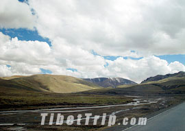
on the Way from Tuotuo River to Nakchu-Tibet Railway scenery

The Tuotuo River originates from the glaciers on Gelandong Mountain, southwest of the main peak of Tanggula Mountain. The river is renamed 'Tongtian River' (a famous river that appears in the legendary story 'Journey to the West') when flows into Dangqu Region of Yushu Tibetan Autonomous Prefecture in Qinghai, and called 'Jinsha River' in Sichuan Province.

At an altitude of 4,533 m (14,872 ft), Tuotuo River Town is the lowest spot between Kunlun Mountain Pass and Tanggula Mountain Pass. The weather is preferable here, so it forms a relatively large and lively area. There are houses, stores, restaurants, hostels, coach station, gas station, military station, post office, school, meteorological station, hydrological station, geological team and government offices. Travelers to Golumd and Lhasa prefer to have a rest here as it takes about a day to get to Golmud and Nakchu and more than one day to Lhasa.

The bridge of the Qinghai - Tibet Highway is built on the waterfront of the river in the town, which is also the best place to view the river scenery.

 Back to Map of the Tibet Railway Scenery

Comments and Questions